 |
The Agnes Street Field School ended on
June 25, and we're now completing final excavations on the two-story
outhouse before beginning lab processing and analysis in the coming
year. The field school identified a well, the two-story outhouse,
and one likely single-hole outhouse that each had dense deposits of
twentieth-century artifacts. In addition to these features we also
excavated a handful of units in back yard spaces. The well and single-hole outhouse each contained dense assemblages of food remains including a vast range of animals that either made it to dining rooms or lived in the neighborhood. The two-story outhouse has not yet been fully excavated, but it has already included several hundred bottles. Much of the material culture from the outhouses and well dates to after 1920, which is not typically a period archaeologists have studied very closely. Nevertheless, the artifacts should tell an interesting story about everyday lifeways--the material culture should provide a lot of insight into food and bottled consumption patterns, for instance--as well as bigger issues, such as the shifts fostered by urban renewal and migration into the near-Westside since World War I. This is some of what we've found out so far. |
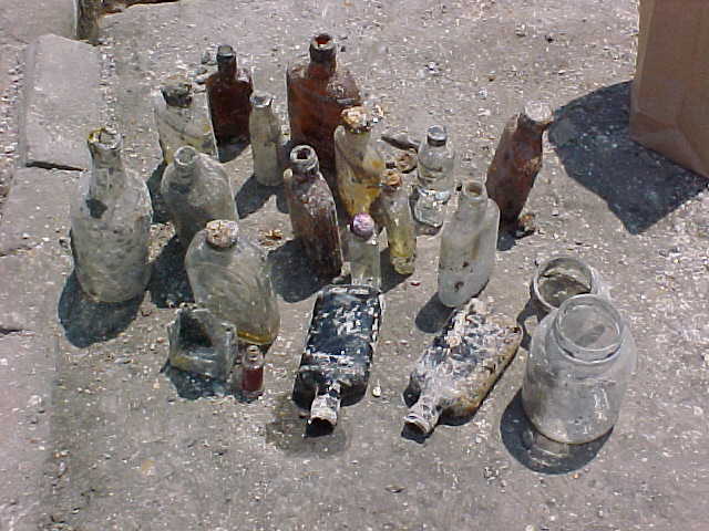 |
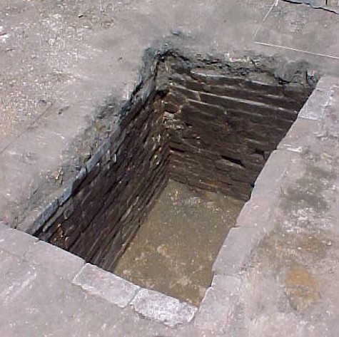
Two-story outhouse The most unusual architectural feature on the site--if not the whole campus--is the two-story outhouse at 458-460 Agnes Street. We have not yet reached the base of the pit that once sat beneath this monumental privy, so we do not know its depth, but the brick-lined outhouse was nearly eight-feet square, had large corner posts, and was backfilled around 1950 with a dense deposit of bottled goods. The bottles contained almost every Cold War-era bottled good, including medications like Milk of Magnesia, personal products like Jergens, and a vast range of Midwestern sodas and liquor. |
| It is not clear exactly who filled the outhouse: that is, one or all of the Agnes Street households may have dumped their trash into this feature, and neighbors may have contributed to the fill as well. The outhouse fill includes many fine layers of coal ash that suggest the pit was filled in a series of successive episodes, rather than in one tremendous house-cleaning. | 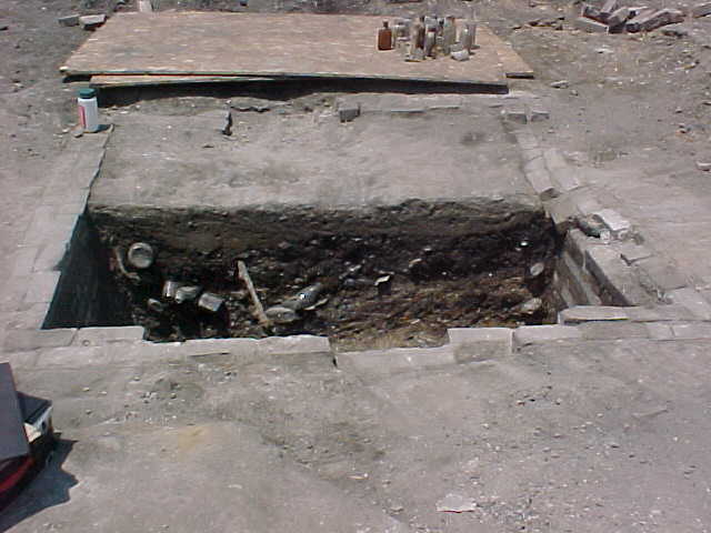 |
|
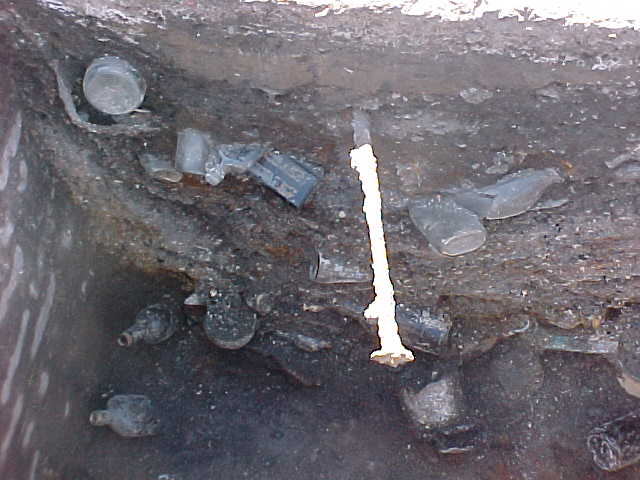 |
Left (thumbnail): the outhouse
was excavated in halves so we can more clearly see variation in deposits. Right: this profile shows bottles and coil ash layers within the outhouse. |
|
|
|
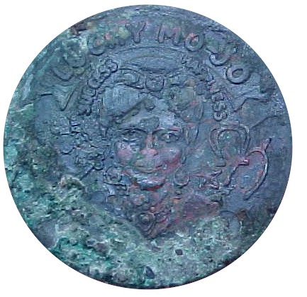
Left (thumbnail): This
"Lucky Mo-Jo" coin from the outhouse was typical of the many good luck pieces
whose popularity peaked in the 1930's. The Mojo coin includes typical symbolic features from such coins: a Swami is
surrounded by a horseshoe and wishbone encircled in the words
"success" and "happiness," and the coin's
well-worn obverse (left bottom) includes an elephant, four-leaf clover,
and the word "luck" emblazoned across its face. Our bronze
coin still has faint traces of gilding that once covered the face of the
coin but have now deteriorated after a half-century in the outhouse. Mass-produced good luck pieces like this borrowed from a vast range of cultural symbolism: "mojo," for instance, is a concept taken from hoodoo. Hoodoo is an umbrella term for a range of African religious practices that were adapted in the New World. Archaeologists have identified many hoodoo deposits associated with African Americans, including examples in Annapolis, Maryland's Brice House, Slayton House, and Carroll House (compare Mark Leone's video clip comments on Hoodoo archaeology in Annapolis). Most 1930's good luck pieces, though, were hawked as souvenirs or made by advertisers ranging from auto clubs to politicians to Hopalong Cassidy. The lucky elephant icon, for example, was a popular motif in the US, adapting the Hindu image of the elephant-headed god of luck Ganesha, and horseshoes, clovers, and wishbones all are well-established symbols of good fortune. A thorough review of hoodoo and some examples of 20th-century good luck tokens can be found at the Lucky Mojo web page; also compare the Hoodoo: Ancient African Magical Tradition page. |
|
|
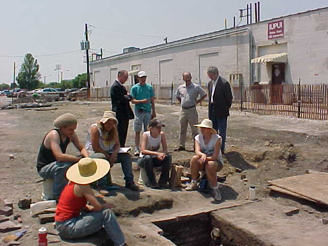 |
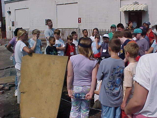
Right (background,
from left): Gail Plater (Assistant
Dean, Development and External Affairs),
Chancellor Charles Bantz, me, Anthropology Chair Rick Ward, and School
of Liberal Arts Acting Dean
Bob White look over the two-story outhouse (also left thumbnail top).
|
 |
 |
 |
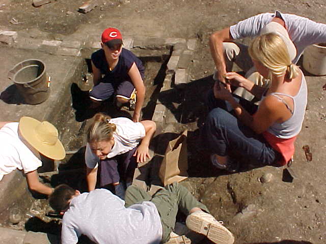
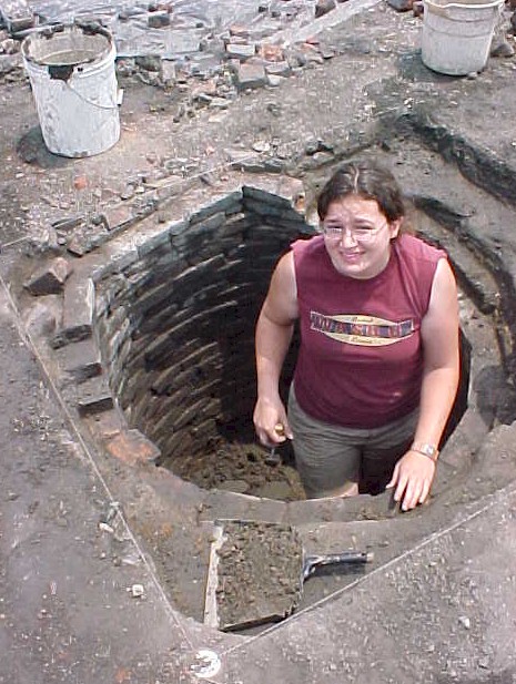
Left and right: excavating the outhouse | 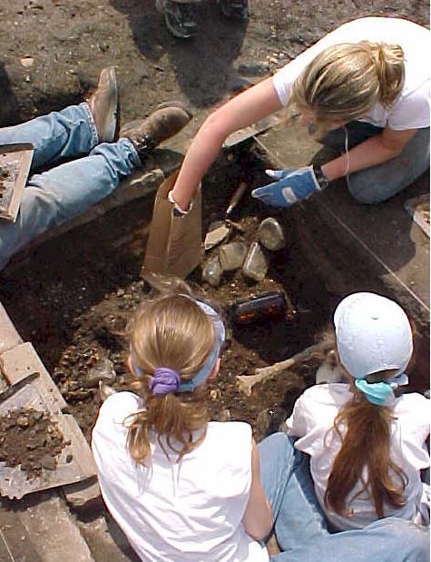 |
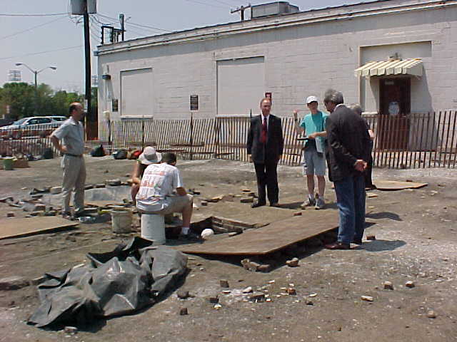 |
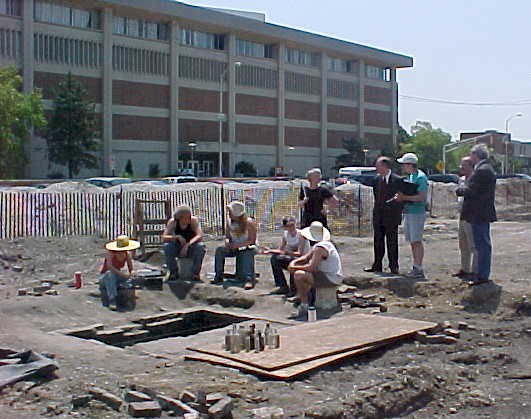
Left: Chancellor Bantz and company visit the 452 Agnes Street outhouse. |
| We are fortunate to have very
detailed historic maps and photographs for the Agnes Street block, but
these maps were produced at a vast range of scales that make it difficult
to always determine exactly where an archaeological feature falls on both
historic maps and the contemporary landscape. University
administrators directing preservation and expansion also need to be able
to place historic and archaeological features on contemporary maps.
Bob E. Hall in the Center for Earth
and Environmental Science and Dept. of Geology has begun to work with
us to produce maps that could conceivably include archaeological,
historical, geological, and environmental features on contemporary maps
using global positioning system. GPS
uses satellites that transmit signals to a receiver, allowing the receive
to accurately record their position; that record can subsequently be
placed in mapping programs that can scale those positions and historical
data onto a single scale map. This map (right) places points on the
Agnes Street site on a 2002 aerial picture of the site. Eventually
such a map could include "layers" representing prehistoric
environment, historic map features, archaeological deposits, contemporary
landmarks, and planned University structures and spaces. For Bob's pictures of the GPS survey and excavations, visit his archaeology survey page. |
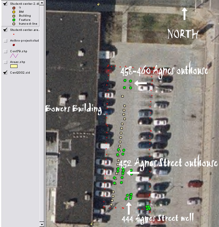 |
| Above: On this map the red dots mark the perimeters of the excavation area. The green dots are corners of archaeological features like the outhouses and well, plus other units. The brown line down the center marks five-foot intervals along our excavation grid. |
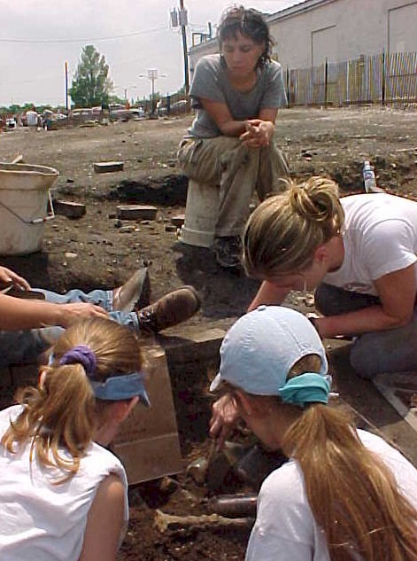
| 452 Agnes Street outhouse The brick-lined feature at the rear of 452 Agnes Street is located in the rear yard like most privies in this neighborhood, but it turned out to be quite shallow for an outhouse and may be something else entirely. The dry-laid brick feature was roughly 3 by 4 feet in size at the end of a laid brick sidewalk extending from the house's back door. Unlike most outhouses, the feature was just five feet deep, lined with dense wood planks at its base that rested on a deposit of sand and pebbles. Fragments of wood along the walls throughout the feature suggest it had a wood lining as well. Unlike the two-story outhouse, this assemblage includes fewer bottles and slightly more bones. |
 |
|
|
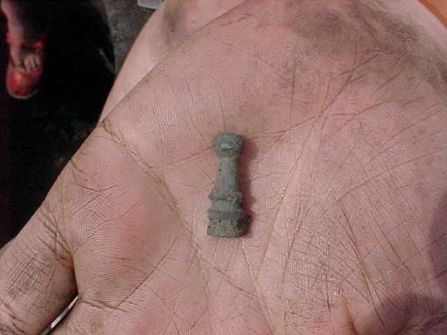
Left: a bronze chess pawn from
the well Right: excavating the 452 Agnes Street feature Far right: Genesis tours the site with an Indiana State Museum day camp |
|
|
 |
444 Agnes Street
Well The well at 444 Agnes Street was excavated to roughly six feet below the contemporary surface; when water began to seep into the unit at that point, we discontinued the well's excavation. The well contained a dense bone sample that included most every animal that ever was eaten in this area, and a few that were not eaten particularly often: in addition to commonplace pig, cow, and chicken bones, the well contained groundhog, raccoon, chipmunk, rabbit, and rats. With the exception of rats, any of these animals might well have made it to the table as food, but this would not have been the sort of diet championed by Cold War cookbooks. Since we have not analyzed this sample yet, we cannot say what animals were reaching the table as food and which were being discarded into the well as pests. An analysis of butchery marks on the bones and an assessment of how many animals (and what parts of their bodies) are represented in the feature will help us better understand consumption in this home. |
Excavation of the two-story outhouse will continue for a few more days and then all the artifacts will begin to be washed and analyzed in the IUPUI Archaeology lab. If you're interested in touring the lab or helping with the lab analysis, email Paul Mullins or call 274-9847.
|
|
Last updated June 30, 2003